
Australia Has 15 Official Great Walks — The Complete Hiking Guide (2026)

Australia Travel Hub contains affiliate links and is a member of the Amazon Services LLC Associates Program. If you make a purchase using one of these Amazon links, we may receive compensation at no extra cost to you. See our Disclosure Policy for more information.
Hiking in Australia looks straightforward until you realise most visitors never make it past the same five trails.
There’s a government-recognised program called the Great Walks of Australia — 15 officially designated multi-day experiences — and two brand-new trails just launched in 2026 that almost nobody has written about yet.
What Is the Great Walks of Australia Program?
The Great Walks of Australia is a collection of 15 premium multi-day hiking trails across the country, selected for their ecological significance, infrastructure quality, and visitor experience.
Not all iconic Australian hikes make the list — but it’s a solid starting point for serious hikers planning their first or next big Australian adventure.
The 15 current Great Walks are spread across every state and territory.
They range from a long weekend to two weeks on the trail.
The Best Multi-Day Hikes in Australia
🚶♀️Overland Track, Tasmania 🏆
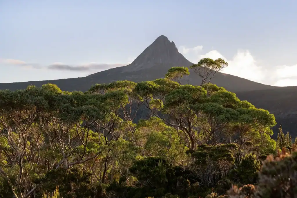
The Overland Track is arguably the most iconic multi-day hike in the country — 65km through the heart of Cradle Mountain-Lake St Clair National Park, taking 5 to 9 days depending on your pace.
The details
- Distance: 65km end-to-end (Ronny Creek to Narcissus or Lake St Clair)
- Duration: 5–9 days
- Permit: $300/adult (October–May regulated season) — book through Parks Tasmania
- Season: October–May only in the regulated direction (north to south)
- Base huts are included with the permit — a sleeping bag and tent are still recommended
The alpine landscape changes constantly — button grass moorland, pencil pine forests, glacial lakes, and views of Barn Bluff and Mt Ossa (Tasmania’s highest peak at 1,617m).
I’ve spoken to dozens of hikers who’ve done this one, and not a single person has said it wasn’t worth it.
Best for: Experienced hikers who want Tasmania’s signature landscape without the guesswork. Book well in advance — permits sell out.
🚶♀️Three Capes Track, Tasmania
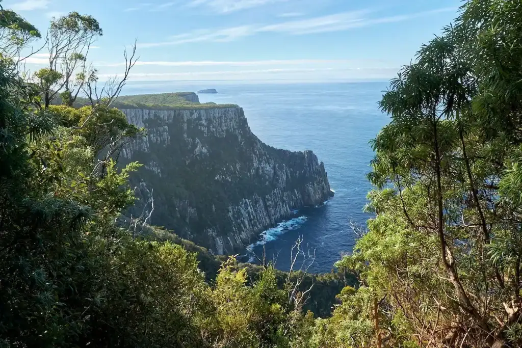
The Three Capes Track is 48km along the Tasman Peninsula, taking 4 days and ending at Port Arthur.
The details
- Distance: 48km
- Duration: 4 days
- Pricing: packages from $625/adult (huts fully catered, no tent needed)
- Season: Year-round, best October–April
- Book through Parks Tasmania
What sets this apart is the infrastructure — purpose-built eco-huts with bunks, cooking facilities, and composting toilets, all perched above some of the highest sea cliffs in the southern hemisphere.
The cliff faces at Cape Pillar drop 300m straight into the Tasman Sea. It’s dramatic in a way that photos don’t fully capture.
Best for: Hikers who want a premium, low-logistics experience. Not a budget option, but genuinely world-class.
🚶♀️Larapinta Trail, Northern Territory
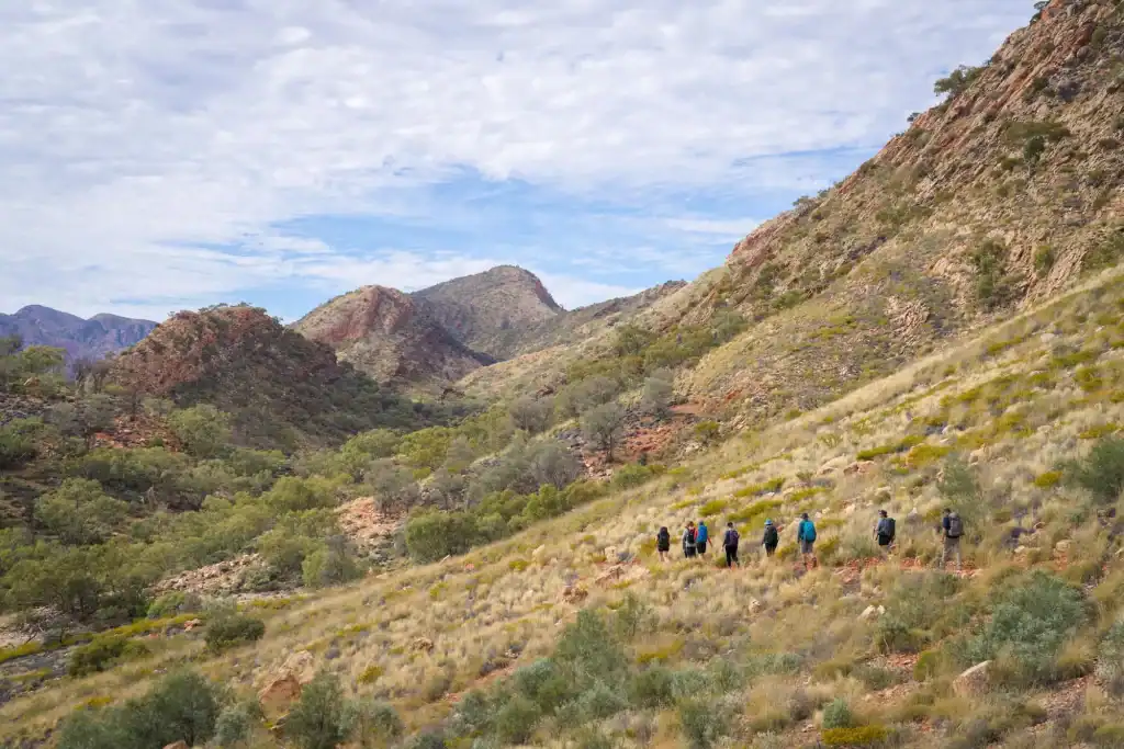
The Larapinta Trail is one of Australia’s great desert walks — 223km along the spine of the West MacDonnell Ranges, passing through ancient gorges, waterholes, and red rock country.
The details
- Distance: 223km (12 sections, can be done in sections)
- Duration: 12–14 days full trail
- Camping: $10/night per person at designated campsites + walking trail fee of $25/day (capped at $125) + NT Parks pass ($60) — book via NT Parks
- Season: April–September only (summer heat is dangerous — temperatures regularly exceed 40°C)
- Alice Springs serves as the base
Most hikers don’t complete the full trail in one go — the Standley Chasm section and the Ormiston Gorge section are consistently rated the most spectacular.
The night sky out here is extraordinary — the MacDonnell Ranges have zero light pollution, which is its own reason to come.
Best for: Experienced hikers comfortable with remote desert conditions. A PLB (personal locator beacon) is non-negotiable on this trail.
🚶♀️K’gari Great Walk, Queensland
Formerly known as the Fraser Island Great Walk, this 90km route traverses K’gari — the world’s largest sand island and the only rainforest growing on sand dunes anywhere on Earth.
The details
- Distance: 90km
- Duration: 6–8 days
- Camping: fees apply; book via Queensland National Parks
- Season: Year-round — May–September is most comfortable (avoid summer heat and storms)
The landscape here is unlike anything else — crystal-clear freshwater perched lakes like Lake McKenzie, ancient rainforest, and towering coloured sand cliffs at The Pinnacles.
Dingoes are wild and active on K’gari. Keep food secured and never approach them.
Best for: Hikers who want something genuinely unique. The combination of sand, rainforest, and lakes is found nowhere else.
🚶♀️Thorsborne Trail, Queensland
The Thorsborne Trail on Hinchinbrook Island is 32km of rugged, remote coastal rainforest — and one of the hardest permits to get in Australia.
The details
- Distance: 32km
- Duration: 4–7 days
- Permit: strictly limited to 40 walkers at a time — book via Queensland National Parks
- Season: April–October (wet season flooding makes it dangerous November–March)
Hinchinbrook is Queensland’s largest national park island, and the trail passes through mangroves, creek crossings, and quiet beaches that feel almost impossibly remote.
This one books out months — sometimes more than a year — in advance. If it’s on the bucket list, book early — demand is high.
Best for: Experienced, self-sufficient hikers who want genuine wilderness. Not beginner-friendly.
🚶♀️Grampians Peaks Trail, Victoria
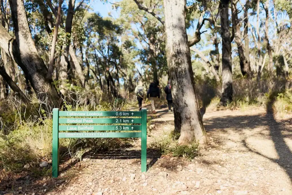
The Grampians Peaks Trail is 164km through the Grampians, taking 13 days and linking most of the major peaks.
The details
- Distance: 164km
- Duration: 13 days
- Camping: designated sites with fees, book via Parks Victoria
- Season: Spring and autumn are best — summer can be hot and fire-prone
The trail passes through Djab Wurrung and Jardwadjali Country and passes landmarks like the Pinnacle, Mt William (the highest peak in the Grampians), and the reed beds at Zumsteins.
Section camping and multi-day options make it easy to break this into shorter trips over multiple visits.
Best for: Hikers who want to experience one of Victoria’s most iconic landscapes in depth.
🚶♀️Great Ocean Walk, Victoria
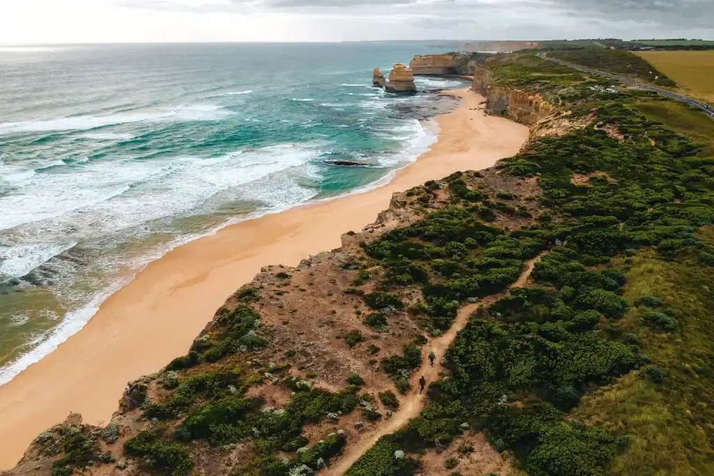
The Great Ocean Walk runs 110km from Apollo Bay to the Twelve Apostles — one of the most dramatic coastal walking routes in Australia.
The details
- Distance: 110km
- Duration: 8 days (can be done in sections)
- Camping: designated sites, book via Parks Victoria
- Season: October–April is best; winter brings rain and strong winds
The final day’s walk to the Twelve Apostles — arriving on foot rather than by coach from Melbourne — is one of those experiences that just lands differently.
Best for: Coastal hikers and first-time multi-day walkers. Well-marked, good hut infrastructure.
🚶♀️Falls to Hotham Alpine Crossing, Victoria
The Falls to Hotham Alpine Crossing is 37km through the Victorian High Country, taking 3 days.
The details
- Distance: 37km
- Duration: 3 days
- Camping: self-contained required — book hut access via Parks Victoria
- Season: November–April only (snowbound the rest of the year)
It traverses the Main Range above 1,700m, through subalpine meadows, snowgum woodland, and some of the most open sky I’ve seen on any Australian trail.
Best for: Hikers comfortable with exposed alpine terrain. Weather changes fast at this elevation — be prepared.
🚶♀️Bibbulmun Track, Western Australia
The Bibbulmun Track is one of the world’s great long-distance walks — 1,000km from Kalamunda (near Perth) to Albany on the south coast.
The details
- Distance: 1,000km
- Duration: 6–8 weeks, full end-to-end
- Cost: Free — about 50 campsites with three-sided shelters, tank water, and pit toilets
- Season: September–November (wildflower season) or April–June
Most hikers tackle sections rather than the full trail. The southern jarrah and karri forests are particularly beautiful — towering trees, red dirt trails, and wildflowers that absolutely carpet the ground in spring.
The free hut system is genuinely impressive infrastructure for a public trail.
Best for: Long-distance walking enthusiasts or anyone who wants a section of WA forest without a permit headache.
🚶♀️Jatbula Trail, Northern Territory
The Jatbula Trail is 62km through Nitmiluk (Katherine Gorge) National Park, ending at Leliyn (Edith Falls).
The details
- Distance: 62km (one-way, south to north — Nitmiluk Gorge to Edith Falls)
- Duration: 5–6 days
- Camping: fees apply; book via NT Parks
- Season: May–September only
The trail passes through Jawoyn Country, with swimming holes, ancient rock art, and a genuinely remote Top End landscape.
Seventeen Mile Falls and the Crystal Falls swimming hole are highlights that very few international visitors ever reach.
Best for: Dry-season hikers who want the Top End beyond the tourist circuit.
🚶♀️Heysen Trail, South Australia
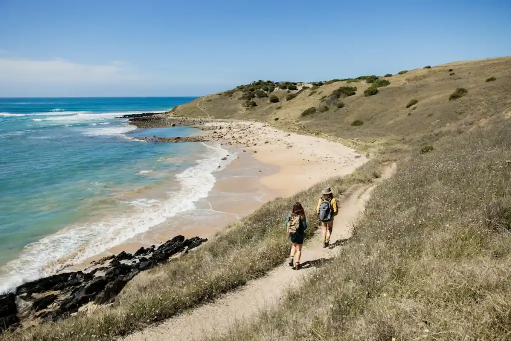
The Heysen Trail stretches 1,200km from Cape Jervis on the Fleurieu Peninsula to Parachilna Gorge in the Flinders Ranges.
The details
- Distance: 1,200km (sections from a day to weeks)
- Duration: 6–8 weeks full trail
- Cost: Free — some section camping fees apply
- Season: April–October (summer section closures apply for the northern Flinders sections due to fire risk)
This is my home turf. I’ve walked sections of the Heysen through the Adelaide Hills and up into the Flinders, and the contrast between the two is remarkable — eucalypt forest and creek crossings in the south, ancient red gorges and saltbush plains up north.
The Flinders Ranges section alone is worth planning a trip around.
Best for: South Australian locals and visitors who want more than the beaches. Hugely underrated internationally.
🚶♀️Jagungal Wilderness Circuit, New South Wales
The Jagungal Circuit is a 42km loop in the Kosciuszko National Park wilderness area — probably the most underrated multi-day alpine hike in NSW.
The details
- Distance: 42km loop
- Duration: 3–4 days
- Cost: Free — no permit required, though park entry fees apply
- Season: December–April (snowbound in winter)
It sits above 1,600m, loops around the flanks of Mount Jagungal (2,061m), and passes the Grey Mare Range with expansive views that simply don’t exist on the more popular Main Range Track.
Unlike the crowded Kosciuszko summit walk, long stretches of solitude are the norm here.
Best for: NSW hikers who want genuine alpine wilderness without a permit system.
⭐ NEW IN 2026: Uluru-Kata Tjuta Signature Walk, Northern Territory
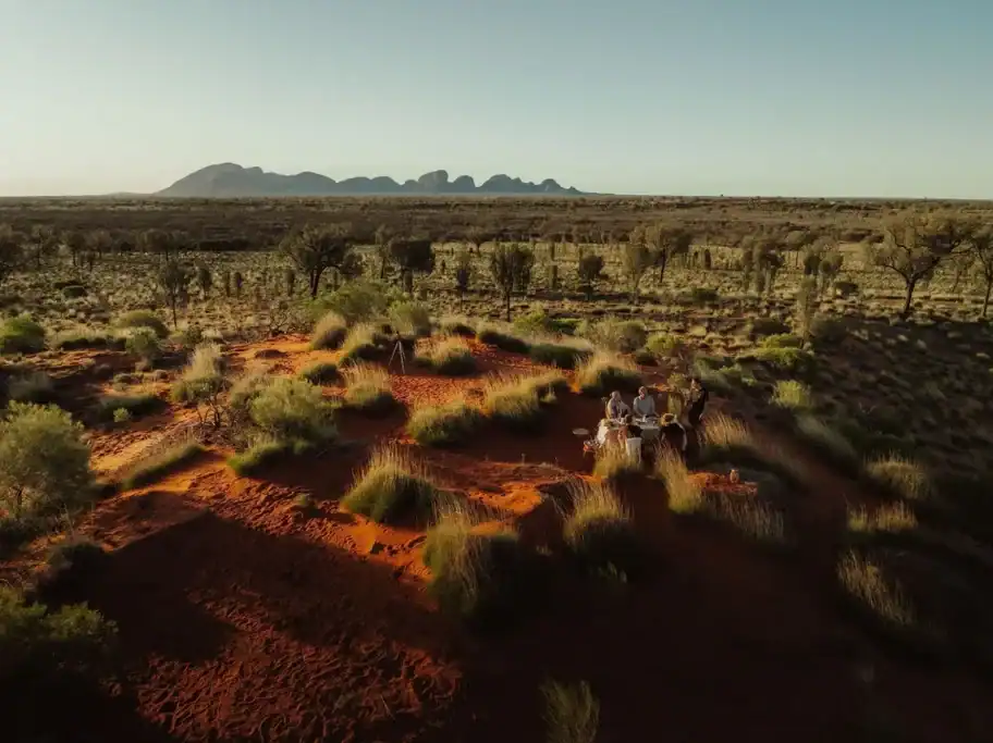
This is the big one. The Uluru-Kata Tjuta Signature Walk launched in April 2026 — the first overnight walk ever permitted inside Uluru-Kata Tjuta National Park.
The details
- Distance: 54km (5 days)
- Duration: 5 days / 4 nights
- Booking: guided only — through Parks Australia-approved operators
- Season: April–September (summer heat makes it unsafe)
- Anangu-led cultural interpretation included
For the first time in history, it’s possible to camp inside the national park and walk through the Country that was previously off-limits to overnight visitors.
The Anangu Traditional Owners were central to the design of this trail, and cultural engagement is woven into every day of the experience — not tacked on.
This is genuinely a once-in-a-generation opportunity, and I expect permits to become extremely competitive within the next year. Book early — this one will fill fast.
Best for: Anyone who’s visited Uluru and felt like they only scratched the surface.
⭐ NEW IN 2026: Ngaro Track, Whitsunday Island, Queensland
The Ngaro Track launched in 2026 — a 32km trail on Whitsunday Island connecting the white sands of Whitehaven Beach to the swirling viewpoint of Hill Inlet.
The details
- Distance: 32km
- Duration: 3 days
- Booking: via Ngaro Track (guided from $1,695/person — self-guided $150/person)
- Season: April–October
The trail passes through Ngaro cultural sites, with beach camping on the island and access to some of the most remarkable coastal scenery in Queensland.
It’s limited to 15 hikers per departure, and the two eco-campsites on the island have tent platforms and composting facilities — genuinely off-grid.
Best for: Adventurous hikers who want something that doesn’t look like anything else on offer in Australia.
Best Day Hikes in Australia
Not every trip calls for a full pack and a week on the trail. These day walks are among the best in the country.
⭐ Bondi to Manly, New South Wales
Most people know the 6km Bondi to Coogee walk — but the full Bondi to Manly walk is 80km, connecting two of Sydney’s most iconic beaches via the Spit Bridge.
It can be broken into day sections and takes 4–5 days to complete in full, but individual sections are excellent day outings from various Sydney suburbs.
The coastal headland stretch between Bondi and Coogee is spectacular, but the northern harbour section through Middle Head and Manly is equally impressive and gets far fewer visitors.
⭐ Waterfall Gully to Mt Lofty, South Australia
The Waterfall Gully to Mt Lofty walk is 8km return through Cleland Conservation Park — a 20-minute drive from the Adelaide CBD.
It climbs from the gorge floor up through native bush to the summit of Mt Lofty at 727m, with views across Adelaide and the Gulf St Vincent on a clear day.
This is the walk I take every interstate visitor on — it feels genuinely wild for something so close to a capital city.
The waterfall at the base is gorgeous after rain.
Distance: 8km return | Difficulty: Moderate
⭐ Warrumbungle National Park — Breadknife Walk, New South Wales
The Breadknife and Grand High Tops loop in Warrumbungle National Park is consistently described by hikers as producing some of the best views of any walk in Australia.
The volcanic Breadknife dyke rises 90m straight up from the park floor — a thin blade of rock visible from kilometres away.
Distance: 14.5km loop | Difficulty: Moderate-hard | Location: Near Coonabarabran, NSW (5 hours north-west of Sydney)
The park is Dark Sky-certified, making it one of the few places in NSW where the Milky Way is genuinely spectacular.
⭐ Valley of the Winds, Kata Tjuta, Northern Territory
The Valley of the Winds loop at Kata Tjuta is 7.4km through the ancient domes — a completely different experience from any walk near Uluru itself.
The walk closes automatically when the temperature at Uluru reaches 36°C, so an early start (before 7 am) is essential in shoulder season.
Distance: 7.4km loop | Difficulty: Moderate | Location: 53km from Yulara
The domes are up to 546m tall, and the gorge trail between them creates a sense of scale that’s hard to describe.
⭐ Carnarvon Gorge, Queensland
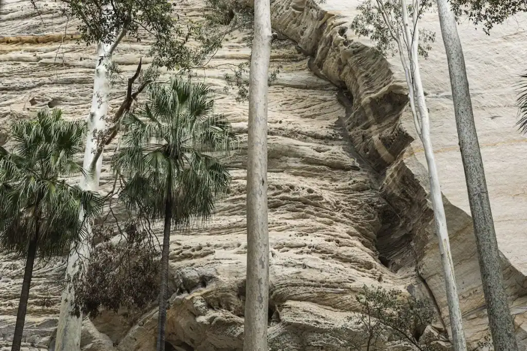
Carnarvon Gorge is a 19.4km return walk into a gorge of white sandstone cliffs, palm forest, and ancient Aboriginal rock art — and it’s one of Queensland’s most underrated destinations.
The main gorge trail passes the Moss Garden, Ward’s Canyon, Art Gallery (a wall of stencil art, engravings, and ochre paintings spanning thousands of years), and the Cathedral.
Distance: 19.4km return | Difficulty: Easy–moderate | Best season: April–October
It’s a long day but an easy gradient. Start early to avoid the heat.
⭐ Cape Le Grand Coastal Track, Western Australia
The Cape Le Grand Coastal Track runs approximately 15km along the Esperance coastline between Rossiter Bay and Lucky Bay, passing through Hellfire Bay — turquoise water, white sand, and granite headlands.
Lucky Bay is where kangaroos lounge on the beach, which makes the trailhead start memorably Australian.
Distance: ~15 km one-way (transport back required) | Difficulty: Moderate | Location: Esperance, WA
⭐ Tarn Shelf Circuit, Mt Field, Tasmania
The Tarn Shelf Circuit is a 12km loop through Mt Field National Park — a 90-minute drive from Hobart and easily a half-day out.
In autumn (March–May), the deciduous beech turns copper and gold across the plateau, making it one of the most photographed hikes in Tasmania.
Distance: 12km loop | Difficulty: Moderate | Season: Year-round, stunning in autumn
⭐ Wilson’s Promontory Southern Circuit, Victoria
The Southern Prom Circuit at Wilson’s Promontory is a 42km, 3-day loop that takes in the southernmost point of mainland Australia.
It consistently sits near the top of every Australian hiker’s list, and after doing part of it, I understand why — the combination of ocean views, fern gullies, and beach camping is extraordinary.
Distance: 42km | Duration: 3 days | Permits required: Yes, book via Parks Victoria
⭐ Coomera Circuit, Lamington National Park, Queensland
The Coomera Circuit in Lamington National Park is 17.4km of subtropical rainforest, creek crossings, and waterfalls — an easy 1.5-hour drive from Brisbane or the Gold Coast.
The falls at Coomera Gorge at the midpoint of the walk are genuinely impressive after rain.
Distance: 17.4km loop | Difficulty: Moderate | Location: O’Reilly’s, Lamington NP
When to Hike in Australia — A Seasonal Guide by Region
This is the section most hiking guides skip, and it’s the most important thing to understand before planning.
Northern Australia (NT, Far North QLD, Kimberley)
- ✅ May–September (dry season)
- ❌ October–April — cyclone season, extreme heat, flooded trails, closed parks
- Many Top End tracks close completely in the wet season
Central Australia (Red Centre)
- ✅ April–September
- ❌ October–March — temperatures above 40°C are common, water sources dry up, Valley of the Winds and other walks close automatically in peak heat
- Night temperatures can drop below 0°C in June–July even when days hit 25°C — pack layers
Southern states (VIC, NSW, SA, WA south)
- ✅ October–April (spring through autumn)
- Spring and autumn are the sweet spots — stable weather, wildflowers in WA in spring
- Summer (December–February) brings bushfire risk, particularly in VIC and SA — check Fires Near Me NSW or VicEmergency before heading out
- Winter hiking is possible in most areas, but bring rain gear
Tasmania
- ✅ October–April for the Overland Track (regulated season, enforced direction)
- Three Capes is year-round, but winter brings rain, wind, and mud
- Summer (December–February) is the driest window
Australia Hiking Safety — What Most Guides Don’t Tell You
This section isn’t here to scare anyone off the trail. It’s here because Australian conditions are genuinely different from hiking in Europe or North America, and knowing these things in advance is the difference between a great trip and an emergency.
✅ Get a PLB
A personal locator beacon (PLB) is the single most important piece of safety equipment for hiking in Australia — more important than anything else packed.
Mobile coverage disappears within minutes of leaving most trailheads.
A PLB sends a distress signal to rescue authorities via satellite, with no subscription fee, from anywhere on the planet.
PLBs are available for hire from Service Tasmania ranger stations and major outdoor gear stores. iPhone 15 and later models have built-in satellite emergency SOS — worth activating in Settings before heading out.
The Celine Cremer case — a woman who went missing in Tasmania after leaving the trail for 15 minutes — is the starkest reminder that distance from the trailhead doesn’t equal safety.
✅ Emergency Number
The emergency number in Australia is 000 — not 911, not 999. From a mobile with no signal, try 112.
The Emergency Plus app is worth downloading before heading out — it uses the phone’s GPS to generate precise coordinates to read out to emergency services.
What3Words is also excellent for identifying locations in areas without addresses.
✅ Heatstroke Is a Real Risk
Trailhead conditions bear no resemblance to mid-trail conditions. A breezy 25°C at the carpark can be 35°C+ in a gorge or on exposed rock with no shade.
Starting before 8 am is essential in warm weather. A minimum of 2L of water per person per 5km is the recommended carry in hot conditions.
If someone’s skin is hot and dry and they’ve stopped sweating, that’s heatstroke — call 000 immediately, as it deteriorates rapidly.
✅ Snake First Aid
Eastern browns, taipans, tiger snakes, and death adders are common across Australian trails.
If bitten:
- Do not wash the bite site — venom residue is used by medics to identify the snake species and choose the correct antivenom
- Apply a firm pressure bandage over the bite and up the entire limb — the venom travels through the lymphatic system, not the bloodstream, so immobilisation slows it
- No tourniquets, no cutting, no sucking
- Call 000 and keep the person completely still
Most snake encounters end without a bite — snakes will move away if given the chance. Watch your step on warm rocks and logs in the morning.
✅ Ticks
Ticks are common in QLD, NSW, and parts of VIC, particularly in rainforest and heath habitats.
Check hair, ears, skin creases, and toes after walks in tick country. Some Australian tick species can trigger an ongoing allergy to red meat (alpha-gal syndrome) that can last for years.
Wear long socks and use repellent in known tick areas. Gaiters are useful not just for snake protection but for keeping ticks off ankles and lower legs.
Guided vs Self-Guided Hiking in Australia
Most Australian trails can be done either way — but the right choice depends on your experience, logistics, and budget.
Self-guided works well for those comfortable with navigation, campsite cooking, and carrying a full pack. Most Great Walks have excellent waymarking, and Parks services publish detailed track notes.
Costs are typically $10–$30/night for campsites.
Guided tours make sense when the logistics are genuinely complex (remote permits, bush camping, resupply), when you want cultural interpretation (Larapinta, Uluru-Kata Tjuta), or when the infrastructure is bundled into the experience (Three Capes, some Overland Track operators who handle pack transfers).
Guided Larapinta tours from World Expeditions and Australian Walking Holidays include pack transfers, gourmet camping food, and cultural stops.
Guided Three Capes experiences run through Tasmanian Walking Co.
Hiking in Australia — Comparison Table
| Trail | State | Distance | Days | Cost | Season | Difficulty |
|---|---|---|---|---|---|---|
| Overland Track | TAS | 65km | 5–9 | $300 permit | Oct–May | Hard |
| Three Capes Track | TAS | 48km | 4 | From $625 pkg | Year-round | Moderate |
| Larapinta Trail | NT | 223km | 12–14 | $10/night + fees | Apr–Sep | Hard |
| K’gari Great Walk | QLD | 90km | 6–8 | Camping fees | May–Sep | Moderate |
| Thorsborne Trail | QLD | 32km | 4–7 | Permit req. | Apr–Oct | Hard |
| Grampians Peaks Trail | VIC | 164km | 13 | Camping fees | Spring/Autumn | Moderate–Hard |
| Great Ocean Walk | VIC | 110km | 8 | Camping fees | Oct–Apr | Moderate |
| Falls to Hotham | VIC | 37km | 3 | Camping fees | Nov–Apr | Hard |
| Bibbulmun Track | WA | 1,000km | 6–8 wks | Free | Sep–Nov / Apr–Jun | Variable |
| Jatbula Trail | NT | 62km | 5–6 | Camping fees | May–Sep | Moderate |
| Heysen Trail | SA | 1,200km | Sections | Free/fees | Apr–Oct | Variable |
| Jagungal Circuit | NSW | 42km | 3–4 | Free (park entry) | Dec–Apr | Moderate |
| Uluru-Kata Tjuta Walk ⭐ | NT | 54km | 5 | Guided only | Apr–Sep | Moderate |
| Ngaro Track ⭐ | QLD | 32km | 3 | Fees apply | Apr–Oct | Moderate |
⭐ New trails launched in 2026
Common Mistakes to Avoid When Hiking in Australia
❌ Underestimating distances. Australian trails are long — a “moderate” trail in the Blue Mountains or Flinders Ranges might have 1,200m of elevation gain.
❌ Always check the full elevation profile, not just the distance.
❌ Leaving trailhead conditions too late. The recommended 7 am start time for desert and inland hikes isn’t conservative — it’s correct. Heat builds fast after 9 am in summer.
❌ Not booking permits far enough in advance. The Thorsborne Trail, Overland Track, and Three Capes Track all sell out months ahead. For the new Uluru-Kata Tjuta Signature Walk, expect demand to outstrip supply significantly in the first season.
❌ Assuming there’ll be phone coverage. Even close to major cities, trail coverage drops out quickly. Offline maps downloaded before leaving the carpark are essential — Avenza Maps works well with government park map downloads.
❌ Skipping the fire danger check. On days of Extreme or Catastrophic fire danger in VIC, SA, and NSW, many parks close entirely. Check Fires Near Me NSW, VicEmergency, or CFS SA before any summer walk in southern states.
Plan Your Hiking Trip
- For Victoria-specific trail guides, see the Hiking Trails in Victoria
- For camping gear advice, see the Australian camping gear guide
- For guided tour operators, visit Parks Tasmania, NT Parks, or Parks Victoria
FAQ — Hiking in Australia
What is the best hike in Australia?
The Overland Track in Tasmania is consistently ranked the best multi-day hike in the country, combining alpine scenery, diverse ecosystems, and well-maintained hut infrastructure. For a day hike, the Warrumbungle Breadknife Walk in NSW and the Valley of the Winds at Kata Tjuta both produce views that are genuinely hard to beat.
Do I need a permit to hike in Australia?
It depends on the trail. The Overland Track ($300/adult), Three Capes Track, Thorsborne Trail, and the new Uluru-Kata Tjuta Signature Walk all require advance booking or permits. Day hikes in national parks usually just require a park entry fee. The Bibbulmun Track, Heysen Trail, and Jagungal Circuit are free or near-free.
When is the best time to hike in Australia?
It depends heavily on the region. The NT and tropical north are open May–September only. Southern states like Tasmania, Victoria, and SA are best October–April. Central Australia is from April to September. Never hike the Top End or Red Centre in summer.
Is it safe to hike alone in Australia?
Solo hiking is common and generally safe, but the risks are higher than in more densely populated trail networks. A PLB (personal locator beacon) is strongly recommended for any remote trail.
Leaving an exact itinerary and expected return time with someone at home is essential — and so is sticking to it.
What gear do I need for hiking in Australia?
The basics are 2–3L water capacity per person, sunscreen (SPF 50+), a hat, a first aid kit with a compression bandage, a PLB for remote hikes, insect repellent, and a snakebite protocol card. For multi-day hikes, add a quality sleeping bag (even in summer — alpine and desert nights get cold), a tent rated for the conditions, and a satellite communication device.
What are the new hiking trails in Australia in 2026?
Two major new trails launched in 2026: the Uluru-Kata Tjuta Signature Walk (54km, 5 days, NT, first-ever overnight hiking inside the national park) and the Ngaro Track on Whitsunday Island (32km, 3 days, QLD, connecting Whitehaven Beach to Hill Inlet through Ngaro Country). Both require advance bookings.
