
Road Trip From Brisbane to Perth – How to Plan the Full Coast-to-Coast Drive

Australia Travel Hub contains affiliate links and is a member of the Amazon Services LLC Associates Program. If you make a purchase using one of these Amazon links, we may receive compensation at no extra cost to you. See our Disclosure Policy for more information.
The Brisbane to Perth road trip is one of the longest drives you can do in Australia, and most people badly underestimate what it actually takes.
I’m talking over 4,300km, several climate zones and one very long, very empty stretch of Nullarbor in between.
Here’s what the drive actually involves, and how to plan it properly.
How Long Does It Take to Drive From Brisbane to Perth
The direct distance between Brisbane and Perth is roughly 4,300km, and non-stop driving takes about 46 hours behind the wheel. Nobody actually drives it non-stop.
Most people take 9 to 14 days to do the crossing properly, with a few short travel days mixed in. If you’re tight on time, you could do it in 5 to 6 days of long driving stints, but you’ll arrive exhausted and miss most of the good stuff along the way.
I’d budget closer to 10 days minimum if this is your first coast-to-coast drive. That gives you enough slack for a rest day, bad weather, or a stop that turns out better than expected.
The Best Route From Brisbane to Perth
There’s really one sensible way to do this drive, with a couple of detour options along the way.
The Southern Route (Most Common)
This is the route almost everyone takes, and it’s the one I’d recommend for a first-timer.
It runs southwest from Brisbane through inland New South Wales, across South Australia, then along the Eyre Highway through the Nullarbor into Western Australia.
Here’s the rough shape of it —
✔️ Brisbane to Goondiwindi — via Toowoomba, about 350km
✔️ Goondiwindi to Broken Hill — through inland NSW via Moree, Walgett and Bourke, roughly 1,150km, best split over two days with an overnight around Bourke
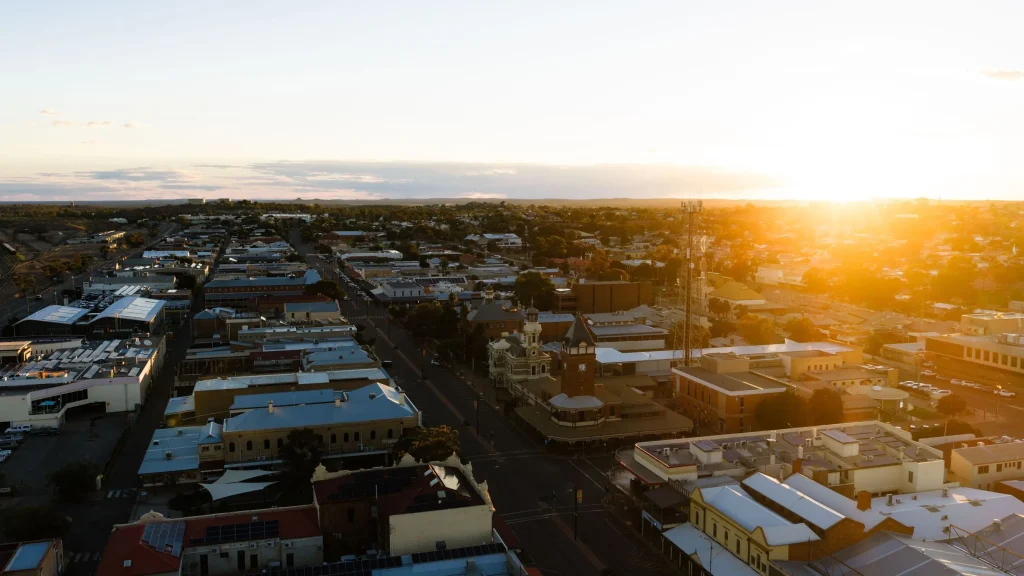
Photo Credit: Tourism Australia
✔️ Broken Hill to Port Augusta — crossing into South Australia, about 410km
✔️ Port Augusta to Ceduna — along the Eyre Peninsula coast, about 470km
✔️ Ceduna to Norseman — the Nullarbor crossing itself, about 1,200km
✔️ Norseman to Perth — through the Goldfields and Wheatbelt, about 720km
A quick word on road surface – the Bourke to Wilcannia stretch has some unsealed sections.
If you’d rather keep the whole drive on bitumen, run Bourke to Cobar to Wilcannia instead, which barely adds any distance.
There’s also a fully sealed inland alternative that skips Bourke altogether, running Moree to Dubbo to West Wyalong to Hay to Mildura to Renmark and into Port Augusta – longer on the clock, but every kilometre sealed.
That’s the backbone of the trip. Most of the interesting stops sit just off this line.
The Outback Queensland Route (Longer, More Remote)
Some drivers head west out of Brisbane through Charleville, Cunnamulla and Longreach before turning south to meet the southern route near Broken Hill, or continuing further north through the Territory.
A few push all the way through Winton to Alice Springs and Uluru before cutting across to Kalgoorlie, turning the trip into a full central Australia crossing rather than a Brisbane to Perth drive with a detour.
Either version adds real days and remoteness, so I’d save it for a second attempt once you know what a long outback drive actually feels like.
If a shorter version sounds more like it right now, my round-up of road trips from Brisbane has plenty of options closer to home.
A Detour Through Adelaide
If you’ve got a spare day or two, swinging south to Adelaide before rejoining the Eyre Highway is a solid call.
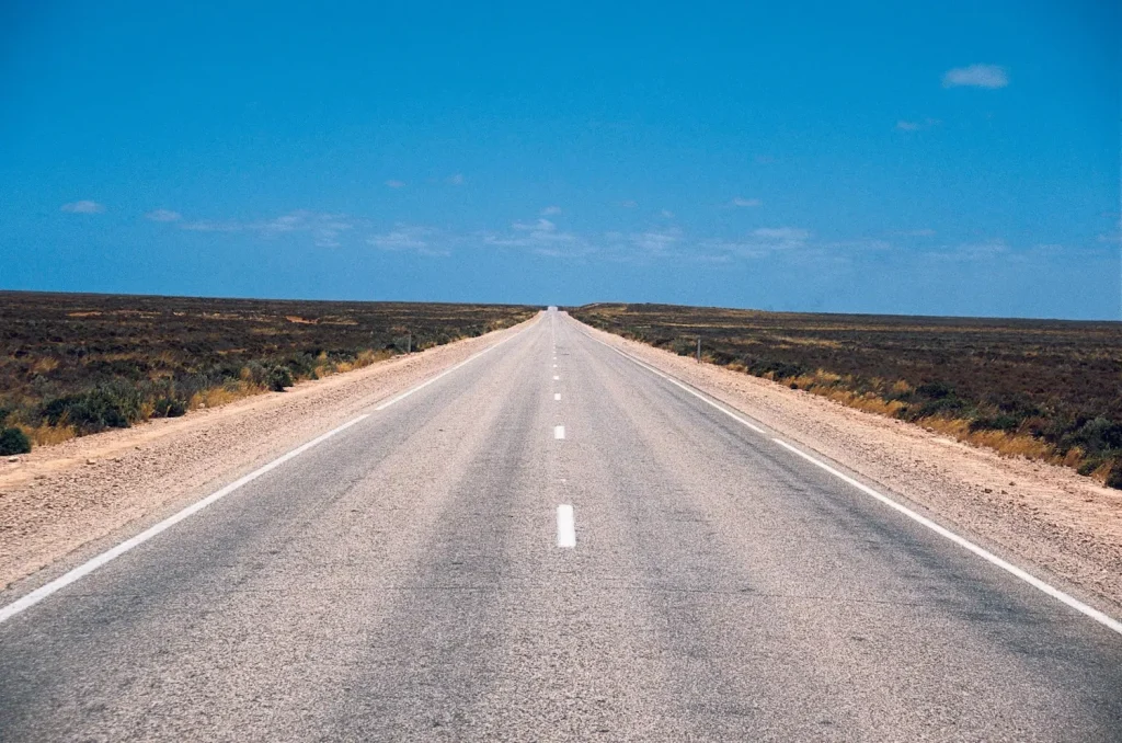
Photo Credit: Tourism Western Australia
It’s about a 600km round trip out of your way, but it breaks up the drive with a proper city stop and a night in a real bed before the Nullarbor.
My Adelaide itinerary covers what to do if you’ve got a night or two there. It’s also worth comparing this drive against my wider best road trips in Australia round-up before you commit to the full crossing.
The Coastal Route via Sydney and Melbourne
If you’ve got three weeks or more and want to work the east coast and Victoria into the trip, running Brisbane to Sydney, then the Hume Highway to Melbourne, then across to Adelaide, is a proper alternative to the direct inland run.
It roughly doubles the total distance, so it suits people treating this as one big lap of the country rather than a coast-to-coast dash.
Break up Brisbane to Sydney with a night in Byron Bay, Yamba or Port Stephens.
Sydney to Melbourne on the Hume is efficient driving, and Canberra is an easy stop if you want a look without much of a detour. Give Melbourne a couple of days before heading further west.
From Melbourne to Adelaide, drive a short stretch of the Great Ocean Road rather than the whole thing, then cut inland past the Grampians.
The full coastal run gets busy over the January school holidays, so this saves time without missing the best of it.
From Adelaide, you’re back on the Eyre Highway and the same Nullarbor route described above.
Best Places to Stop on the Way
Queensland Leg
Toowoomba is the obvious first stop, about an hour and 40 minutes from Brisbane on the Warrego Highway, longer in peak traffic.
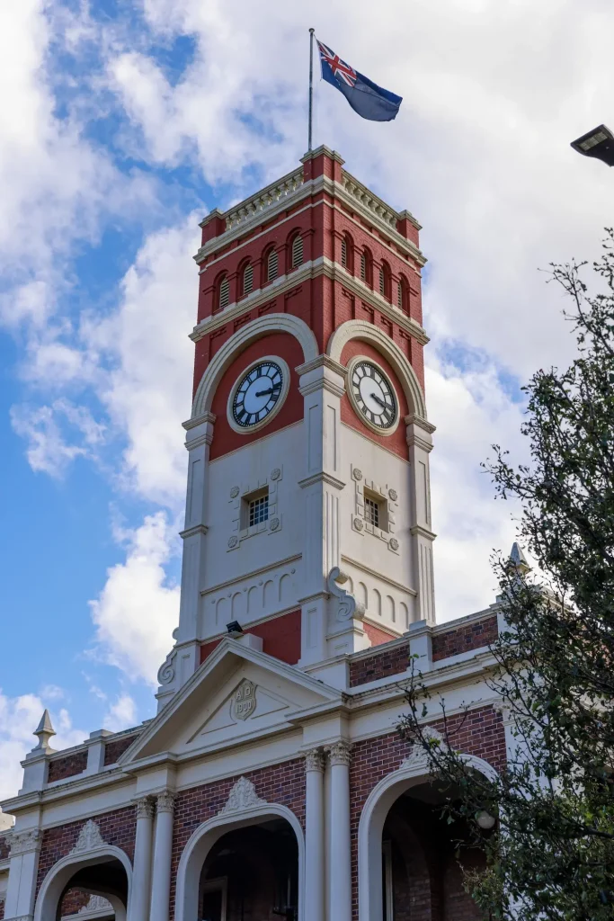
Photo Credit: Tourism Australia
It’s known as the Garden City, and it’s worth wandering through Queens Park and the Botanic Gardens and grabbing something at one of the cafes on Margaret Street before you push on.
If you’ve got time for a short detour, Girraween National Park near Stanthorpe has excellent granite outcrop walks and is a good stretch-your-legs stop.
Check current conditions on the Queensland Parks website before you go, since track closures happen after rain.
Goondiwindi sits right on the Queensland-NSW border and is a natural overnight stop for day one.
New South Wales Leg
The inland NSW stretch is long and flat, and Broken Hill is the standout stop. It’s a genuine outback mining town with a real main street, decent pubs and the Line of Lode Miners’ Memorial looking over the town.
Two nights here isn’t overkill if you want to actually see it rather than just refuel and leave.
If you’d rather camp than take a motel room, Starview Campsite in Living Desert State Park has tent sites from $12 a person, or $25 a night for an unpowered van site, and looks straight out over the sunset sculptures.
South Australia Leg
Port Augusta marks the start of the true outback feel, sitting at the top of Spencer Gulf.
The Wadlata Outback Centre is a good primer on what’s ahead if you haven’t crossed remote Australia before.
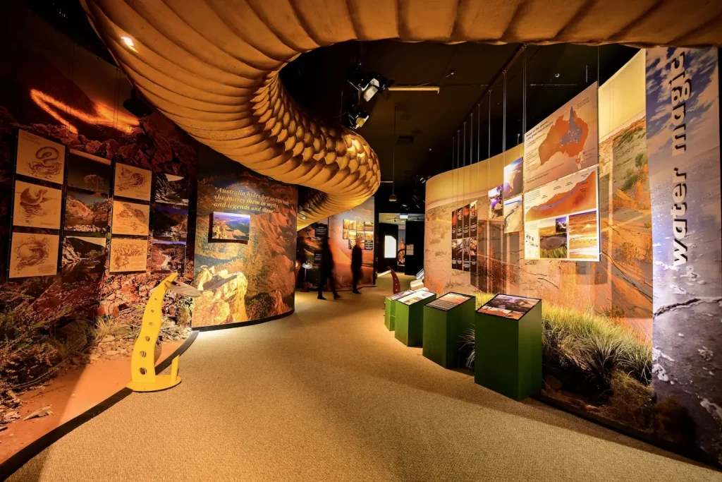
Photo Credit: Tourism Australia
From here you’ll follow the Eyre Peninsula coast to Ceduna, the last proper town before the Nullarbor crossing begins. Stock up here on fuel, food and water — it’s your last real chance for a while.
Crossing the Nullarbor
This is the part everyone asks about, so here’s the honest version.
The Nullarbor stretch itself runs about 1,200km along the Eyre Highway between Ceduna and Norseman.
Services are limited to a handful of roadhouses, and the longest gap without fuel is around 190km, so this isn’t a stretch where you coast in on empty and hope.
Roadhouses along the way include Nundroo, Nullarbor Roadhouse, Border Village, Eucla, Mundrabilla, Madura, Cocklebiddy, Caiguna and Balladonia.
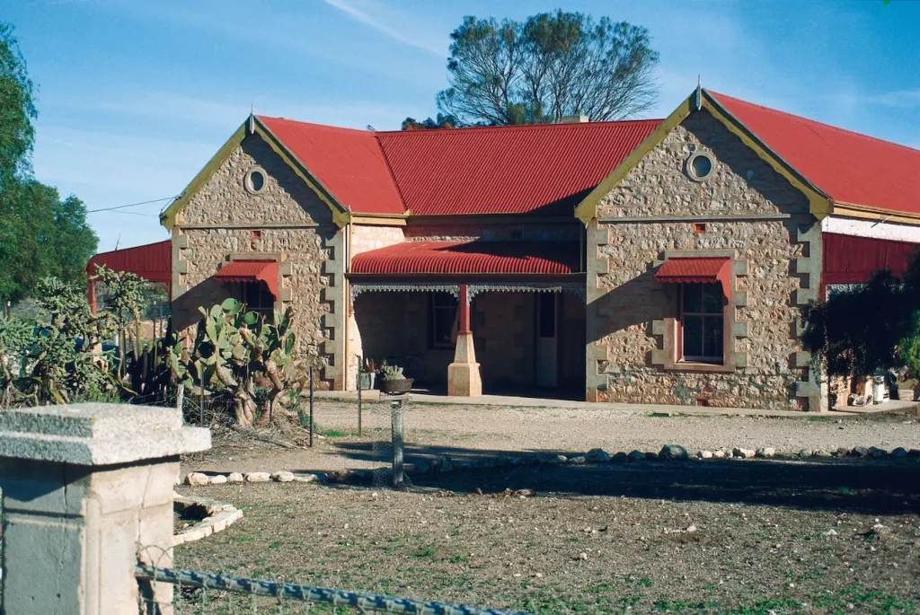
Photo Credit: Tourism Western Australia
Most offer fuel, basic meals and motel-style rooms or a caravan park, but hours can shift with demand and weather, so it’s worth phoning ahead if you’re planning a late arrival.
Gaps between roadhouses generally run about 2 to 2.5 hours apart once you’re on the Western Australia side, with the longest stretch closer to 3 hours, so fuel is never as far away as the empty landscape makes it feel.
One worth planning around is Fraser Range Station, between Balladonia and Norseman, which has stone-built rooms and cottages alongside the usual powered and unpowered sites. It’s popular, so book ahead rather than counting on a room turning up.
A few things worth knowing before you go —
✔️ The 90 Mile Straight, between Balladonia and Caiguna, is the longest straight stretch of road in Australia at 146.6km.
It’s dead flat and dead straight, and fatigue creeps up fast on it — take breaks even when it doesn’t feel necessary.
✔️ Whale watching at the Head of Bight is one of the best reasons to time this trip for winter. Southern right whales calve here roughly May to October, with July and August the peak months.
The Head of Bight Whale Watching Centre has boardwalks right above the cliffs.
✔️ Mobile coverage disappears for long stretches through here. Download offline maps before you leave Ceduna, and consider a satellite messenger if you’re travelling solo.
Telstra and Boost hold a signal noticeably longer out here than Optus or Vodafone, so it’s worth switching or grabbing a prepaid Telstra SIM beforehand. My SIM card guide has more on staying connected in remote parts of Australia.
✔️ Border checks apply when crossing from South Australia into Western Australia, mainly around fruit, veg and honey. Eat or bin what you’ve got before the checkpoint.
✔️ Wombats and kangaroos are a real hazard, not just a cliché. Wombats show up mostly between Port Augusta and Ceduna and hit like a boulder, while kangaroos get worse between Port Augusta and Norseman from dusk onwards.
Avoid driving in the hour either side of sunrise and sunset if you can.
✔️ Download WikiCamps and a fuel-price app such as PetrolSpy or Fuel Map Australia before you lose signal. Between them, they cover free camps, caravan parks and up-to-date bowser prices for the whole crossing.
✔️ Nullarbor Links is a genuine 18-hole golf course strung out along the highway, one hole per roadhouse from Ceduna through to Kalgoorlie. It’s a novelty rather than a serious round, but a fun reason to throw a club in the boot.
Western Australia Leg
Norseman marks the end of the Nullarbor and the start of the Goldfields. From here, Kalgoorlie is a worthwhile stop, about 200km further on.
Photo Credit: Tourism Western Australia
The Super Pit is the big drawcard there, one of Australia’s largest open-cut gold mines. You can view it for free from a lookout or book a proper tour into the site itself.
If you’re not in a rush, Esperance is a genuinely worthwhile detour south of Norseman, with some of the best beaches in the country. I’ve written a full guide to the best beaches in Esperance if you’ve got an extra day or two to spare.
From Kalgoorlie, the drive to Perth passes through the Wheatbelt towns of Coolgardie, Southern Cross and Northam before the final run into the city.
Wave Rock, near Hyden, is a bit of a detour off this line but a genuinely striking natural formation if you haven’t seen it before.
Once you’re in Perth, Swan Valley is the obvious spot to unwind.
It’s a proper wine and food region only 25 minutes from the city centre, with dozens of wineries, breweries and restaurants to work through after a long drive.
Best Time of Year to Do This Drive
Autumn through spring, roughly April to October, is the better window for this trip.
Temperatures across the Nullarbor and outback stretches sit in a much more manageable range, and you’re not fighting 40-plus degree heat with limited shade at every stop.
Winter (June to August) adds the bonus of whale season at the Head of Bight, though nights inland and on the Nullarbor can get properly cold, so pack for it.
Summer (December to February) is genuinely risky on this route. Heat, bushfire season on parts of the inland leg, and long distances between services are a bad combination.
If you have to travel then, stick to driving before 10 am and after 4 pm, avoid the exposed midday hours altogether, and never skip water top-ups.
Book Nullarbor accommodation ahead too, even a simple motel room, since summer demand catches a lot of people out.
How to Do This Without Driving the Whole Way Yourself
Not everyone wants to spend two weeks behind the wheel, and there are good alternatives.
Train — you can cover the same ground by rail, just not on a single service. Journey Beyond’s Great Southern runs from Brisbane to Adelaide over three or four days, and the Indian Pacific continues from Adelaide to Perth, stopping at Cook and Kalgoorlie along the way.
They’re booked as two separate journeys, but together they’re a genuinely relaxing way to see the same country without the driving fatigue.
Flights — a direct flight from Brisbane to Perth takes about 5 hours, which makes sense if the road trip itself isn’t the point and you just want to be in Perth.
Campervan relocation deals — rental companies regularly need vans moved from Brisbane to Perth and offer heavily discounted one-way hire to get them there, sometimes for a fraction of standard rates. It’s worth checking current relocation deals if your dates are flexible.
Budget and Premium Options
Budget travellers can keep costs down by camping at free and low-cost sites along the Nullarbor roadhouses, cooking your own meals, and travelling in the shoulder seasons when fuel and accommodation demand is lower.
Mid-range travellers will find motel rooms at most roadhouses and regional towns, plus caravan park cabins if you want more space and your own bathroom.
Premium travellers have solid options in the bigger stops — proper hotels in Broken Hill, Port Augusta, Kalgoorlie and obviously Perth itself, plus the train option above if comfort matters more than budget.
Fuel is the other big variable. Prices climb noticeably once you’re on the Nullarbor roadhouses compared to city bowsers, so it’s worth topping up fully at Ceduna and Norseman where prices are lower, and only buying what you need to get to the next major town in between.
Who This Trip Suits
Couples get a proper adventure out of this drive, especially with a few detours built in like Esperance or Wave Rock to break up the long stretches.
Families can absolutely do this trip, but I’d stretch the schedule out rather than compress it — kids and 8-hour driving days don’t mix well, and the roadhouse stops become welcome breaks rather than annoying delays if you’ve built in enough time.
Solo travellers should lean toward the shoulder seasons, keep someone updated on your daily progress, and treat the mobile coverage gaps seriously. It’s a safe drive, but it’s a genuinely remote one in parts.
First-timers should stick to the southern route described above rather than the outback Queensland alternative. It’s better serviced, better signposted, and a gentler introduction to long-distance Australian driving.
If this is your first big crossing, it’s worth bookmarking the Australia hub page too, since you’ll be passing through four states and it has guides for each of them.
Know Before You Go
✅ Fatigue is the real risk on this drive, not wildlife or road conditions. The long straight stretches through the Nullarbor and inland NSW are where most incidents happen. Swap drivers regularly if you can, and stop every couple of hours even if you don’t feel tired yet.
✅ Fuel range matters more than usual. Know your vehicle’s realistic range and don’t let the tank drop below half once you’re past Ceduna heading into the Nullarbor.
✅ Carry extra water and food beyond what you think you need, in case a roadhouse is closed or out of stock when you arrive.
✅ Check road conditions before you leave, especially after rain, since some sections can flood or close with little warning.
✅ Book Nullarbor roadhouse accommodation ahead in peak whale season (July and August), since rooms are limited and fill up fast.
✅ Road trains are common on the outback stretches. Give them plenty of room and keep well back rather than tailgating, since debris kicked up from under the rear trailer can hit your windscreen or bonnet. Don’t attempt to overtake unless you can see a long, clear stretch ahead.
