
How to Get to Sea Cliff Bridge Lookout (And Why Bald Hill Might Be Better)

Australia Travel Hub contains affiliate links and is a member of the Amazon Services LLC Associates Program. If you make a purchase using one of these Amazon links, we may receive compensation at no extra cost to you. See our Disclosure Policy for more information.
The Sea Cliff Bridge lookout is the shot everyone wants from their South Coast road trip, and most guides send you straight up a steep unofficial dirt track to get it.
I climbed it myself years ago in white sneakers, having packed nothing sturdier for the trip up from Adelaide, and slipping around on that loose ground is what changed my mind about recommending it.
That track is technically trespassing; it’s caused real injuries and at least one death, and there’s a safer clifftop view five minutes up the road that gets “almost” the same photo.
What Is the Sea Cliff Bridge and Why Does Everyone Photograph It
The Sea Cliff Bridge is a 665 metre balanced cantilever bridge that carries Lawrence Hargrave Drive around the base of the Illawarra escarpment, between the villages of Coalcliff and Clifton.
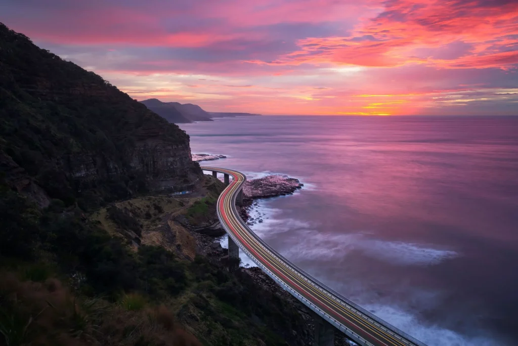
It opened in December 2005, and it was built precisely because the cliff face above it kept sliding into the ocean, which matters later when I get to the unofficial lookout.
The bridge itself is free to drive or walk; there’s no toll, and it’s the standout stretch of the Grand Pacific Drive, the 140km coastal route that runs from the Royal National Park down through Wollongong to Kiama and beyond.
Where Is the Sea Cliff Bridge and How Far From Sydney
The bridge sits on Dharawal Country, about 70km south of the Sydney CBD, roughly 20km north of Wollongong.
Driving from Sydney – take the M1 south and turn off at Helensburgh, following the signs through Stanwell Park onto Lawrence Hargrave Drive. Budget around 1 hour 10 minutes without traffic.
The scenic route – turn off the Princes Highway into the Royal National Park at Loftus and pick up the Grand Pacific Drive from there. This road closes in heavy rain when Audley Weir floods, so check conditions if it’s been wet.
Driving from Wollongong – take Memorial Drive to Bulli, then Lawrence Hargrave Drive north through the coastal villages. It’s about 20 minutes in light traffic, longer on a sunny weekend when the road backs up.
Get an idea of a proper South Coast loop from Sydney in my day trips from Sydney guide – the bridge fits neatly into a full day out with Kiama or Jervis Bay.
How to Get to the Sea Cliff Bridge by Train
You don’t need a car for this one. The South Coast Line runs from Sydney’s Central Station to both Coalcliff and Scarborough stations, on either side of the bridge.
- Coalcliff Station sits at the northern end, with a steep 15-minute walk down to the bridge.
- Scarborough Station sits at the southern end, also about a 15-minute walk.
- The trip from Central takes around 1 hour 10 minutes on a direct service, longer if you need to change trains at Helensburgh (this is what I did!).
- Trains run about once an hour, less often on Sundays, so check Transport NSW before you head out.

A neat option if you’re not driving is to get off at one station, walk across the bridge, then catch the train home from the other end.
There’s also a Premier Illawarra Bus #2 that runs Monday to Saturday between Stanwell Park and Wollongong, stopping at both ends of the bridge, though it doesn’t run on public holidays. Check current timetables here.
If you’d rather skip the planning altogether, a full-day tour from Sydney covers the bridge along with Kiama and the coast without you needing a car or a timetable. 👉 Book here
The Unofficial ‘Secret’ Lookout – What You Need to Know First
This is the bit most guides skip past, and it matters more than the walking directions.
Above the southern end of the bridge, an unmarked dirt track climbs to a clifftop clearing with a well-known view straight down the length of the bridge. It’s the shot you’ve probably seen tagged all over Instagram.

It’s not an official trail. There’s no signage, no fencing at the top, and a fence blocking part of the original access path is there specifically to keep people out.

Walking the railway line route to reach it is illegal, and locals report it’s been actively fined in the past, so it’s not a risk-free shortcut either way.
It has caused real harm. A young man fell 40 metres to his death from this exact clifftop in 2018 after slipping on loose soil, according to Illawarra Mercury reporting on the incident.
There have been other injuries reported since, and the ground at the top is loose, unfenced and gets worse after rain.

I’m not going to pretend the track has vanished, because it hasn’t, and plenty of people still climb it every week.
But I’d only suggest it if you’re a confident, sure-footed walker in proper hiking shoes, going in daylight, staying well back from any edge, and skipping it entirely with kids or in wet weather.
When I went up on a quiet Thursday afternoon, I had the whole clifftop to myself, which felt a lot safer than jostling for space near a loose edge on a crowded weekend.
For everyone else, the next section covers a view that’s arguably better and doesn’t involve trespassing on a known cliff-collapse zone.

Bald Hill – The Safer Clifftop View
Bald Hill Lookout at Stanwell Tops gives you a sweeping view over Stanwell Park Beach and a clear line of sight to the bridge snaking around the coast below, all from a properly fenced platform.
It sits right on the Grand Pacific Drive, so you’ll pass it on the way down from Sydney regardless.
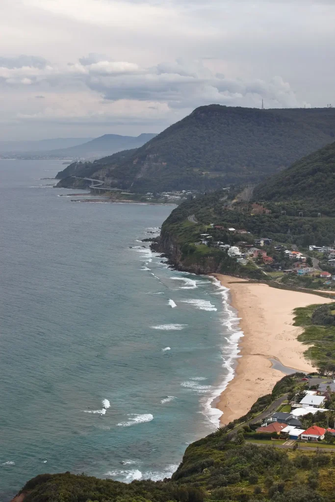
There’s a car park, toilets, the Flying High Café for coffee and ice cream, and on a good day you’ll see hang gliders and paragliders launching off the hillside.
This is the spot I’d send families, anyone with a pram, or anyone who just wants the photo without the risk.
Walking Across the Bridge Itself
Don’t skip the bridge just because you’ve read about the clifftop climb. Walking the 665 metre span is free, flat, and doesn’t require any scrambling.
- It takes most people 15 to 40 minutes return, depending on how many photo stops you make.
- The path slopes gently downhill from south to north.
- A pedestrian footpath runs the full length, separated from traffic.
- Near the northern end, a ramp leads down to the rock platform under the bridge, worth a look if the tide is out, though rogue waves do catch out rock fishers here, so keep your distance from the water’s edge.
Cyclists can use the road shoulder, though check current signage on the day, as rules along this stretch have shifted over the years.
Where to Park at the Sea Cliff Bridge
Parking fills up fast on weekends and around sunrise or sunset, so know your options before you arrive.
🅿️ Clifton end (south) – roadside pull-in parking for around 15 cars, the easiest option for prams or wheelchair access.
🅿️ Rube Hargrave Park, Clifton – opposite the old School of Arts building, a short walk to the bridge.
🅿️ Coalcliff end (north) – a larger car park off Bombora Way, a good option if the Clifton spots are full.
🅿️ Be careful parking on the narrow shoulder right beside the “Sea Cliff Bridge” sign near the unofficial track entrance. I’m not sure if it’s a legal parking spot, but there are usually cars parked there most of the time.

Best Time to Visit the Sea Cliff Bridge
Early morning, before about 9 am, is the quietest and calmest time to walk the bridge. The light is good for photos and the wind hasn’t picked up yet.
After 10 am, the sea breeze tends to strengthen, which makes the bridge blustery and less pleasant, especially with a drone.
Sunset brings a different mood, softer light and fewer crowds once the day-trippers head home.
Winter mornings can be genuinely cold up here, so pack a layer even if Sydney felt mild when you left.
May to November is whale season along this stretch of coast, with humpbacks heading north through winter and back south into spring, visible from the bridge itself on a clear day.
My whale watching guide for Sydney has more on timing if you want a closer look further up the coast.
What Else to See Nearby on the Grand Pacific Drive
Make a day of it rather than just ticking the bridge off a list.
Heading north, the Royal National Park has the famous Figure Eight Pools, a genuinely tough 3km walk each way from the Garawarra Farm car park, on exposed rock and only worth it at low tide in calm surf.
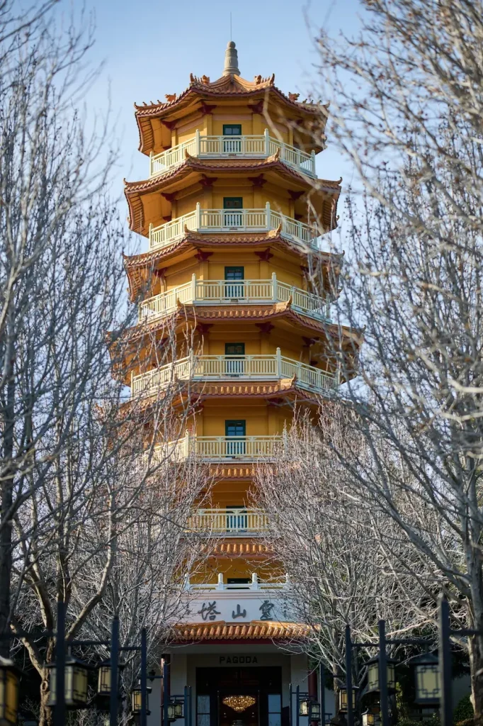
Heading south, Wollongong has the Nan Tien Temple, one of the largest Buddhist temples in the Southern Hemisphere and free to visit, plus its own city beaches.
Further south again, Kiama’s blowhole is one of the more reliable natural attractions on this coast, and Jervis Bay’s white sand beaches make a solid final stop if you’ve got a full day to spend.
If a few pints suit the day better than a swim, the Illawarra leg of the South Coast Ale Trail runs through Bulli and Wollongong, with Resin Brewing housed in the old Bulli Railway Guest House.
Stanwell Park itself, just north of the bridge, has a wide, family-friendly beach and reserve if you want to stretch the day out with a swim.
For a broader look at the state, the New South Wales hub page rounds up more of the coast and beyond.
Where to Eat Near the Sea Cliff Bridge
🍽️ The Imperial at Clifton sits about 500m from the southern end of the bridge, a restored 1911 heritage pub with clifftop ocean views and all-day dining. One of the pricier options on this stretch, but the view earns it.
🍽️ Scarborough Hotel is a short walk from Scarborough Station, family-friendly, pram- and pet-friendly, with solid pub food and ocean views.
🍽️ There’s also a kiosk right on Stanwell Park beach, The Beach Kiosk, for a quick coffee or bite if you’re short on time or the kids need to burn energy at the playground next door. Reviews have been mixed on food and wait times, so treat it as a convenience stop rather than a destination in its own right.
🍽️ Most cafes along this stretch close by early-to-mid afternoon, so don’t count on finding coffee much past 2 pm outside the pubs.
Know Before You Go
✅ The unofficial lookout is not sanctioned and can be dangerous. Treat every warning sign as genuine, not overcautious signage.
✅ Don’t take children up the unofficial track. Bald Hill gives a comparable view without the risk.
✅ Don’t walk the railway line to reach any lookout. It’s illegal and actively fined.
✅ Check the weather before a scenic-route drive through the Royal National Park, since the Loftus route floods and closes in heavy rain.
✅ Sunday trains run less frequently, so if you’re relying on public transport, check the timetable the night before rather than assuming an hourly service.
✅ The unofficial track is genuinely not suitable for young kids, prams or anyone unsteady on loose ground, no matter how the photos on social media make it look.
✅ Dogs are fine on the bridge walk itself on a lead, but skip the unofficial track with a dog too; the terrain is too loose to manage safely.
✅ Solo travellers and couples doing the bridge walk plus Bald Hill can comfortably manage the whole thing in half a day, leaving time to continue down to Kiama or back up to Sydney.
✅ First-timers with limited time are better off prioritising Bald Hill and the bridge walk over the unofficial track, since the safer view genuinely holds up on camera.
